Relative Elevation Model
This map shows a stylized relative elevation model of the Biesbosch made with raster calculations.
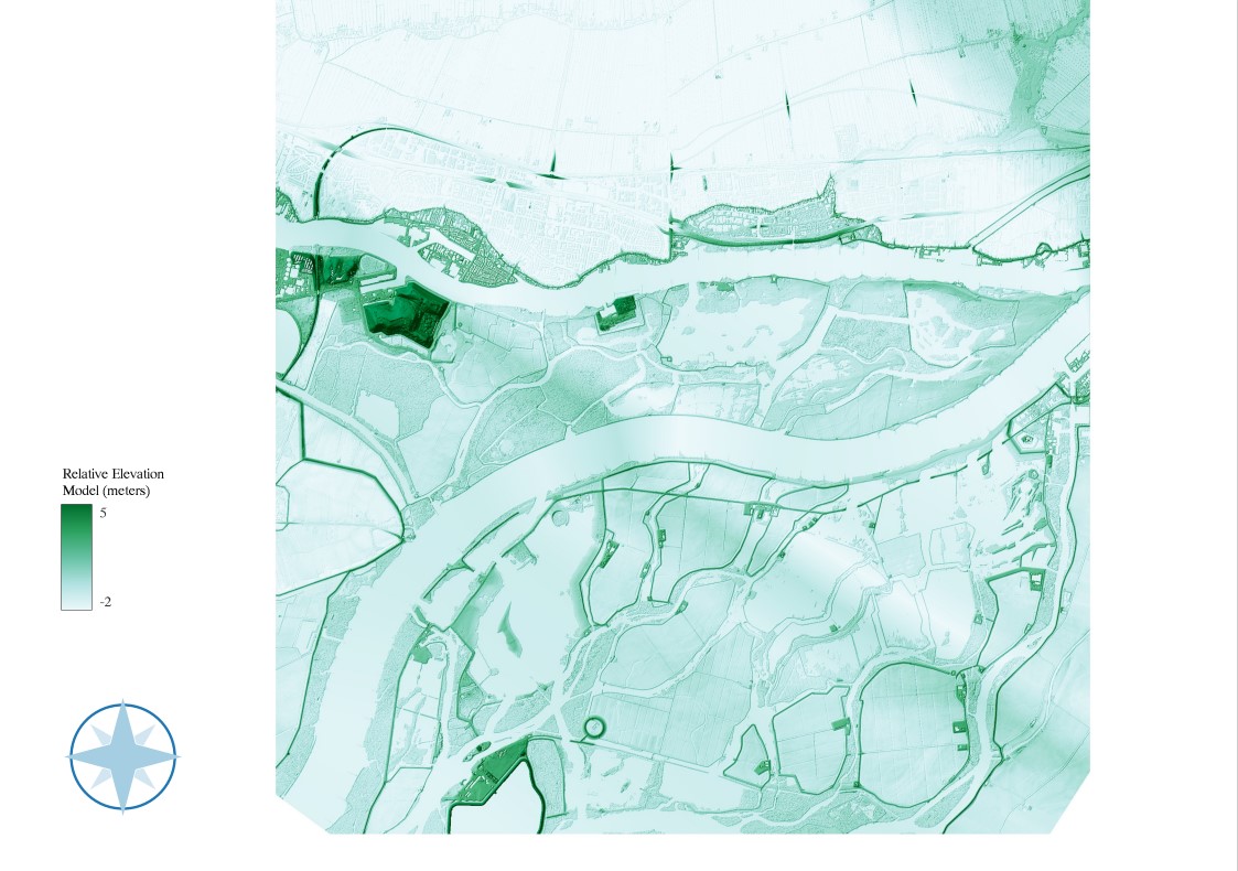
This map shows a stylized relative elevation model of the Biesbosch in Brabant made with raster calculations. The Biesbosch is a low-lying freshwater tidal wetland in the Netherlands, with much of its landscape near or below sea level. This slight elevation variation supports diverse habitats and keeps the river controlled.
To create this detailed elevation map, I first merged the Digital Terrain Model (DTM) files of the area and converted them to a GEOTIFF file to extract the raster data. This conversion was essential to standardize the data format for further processing. I then adjusted the symbology to highlight the range from the highest to lowest elevation, providing a clear visual representation of the terrain. To enhance the map’s definition, I added hillshade. Following this, I created a cross-section of the entire map along the river to analyze the elevation profile. I then interpolated the Digital Surface Model (DSM) to estimate elevation changes based on the cross-section, and finally performed raster calculations to refine the elevation data.
The stretch is chosen to show the dikes and higher ground around the river. However, the area around the river is still relatively low. Therefore, there is significant risk of floods in this area despite of the dikes, especially on the north side. This information is helpful to address issues related to Sustainable Development Goal 15: Life on Land where river management is part of.