about me
 Welcome to my website!
My name is Emma van Weel. I am currently a student at University College Utrecht. I am persuing a double major in Earth and Environment and Molecular Cell Biology with a minor in Linguistics.
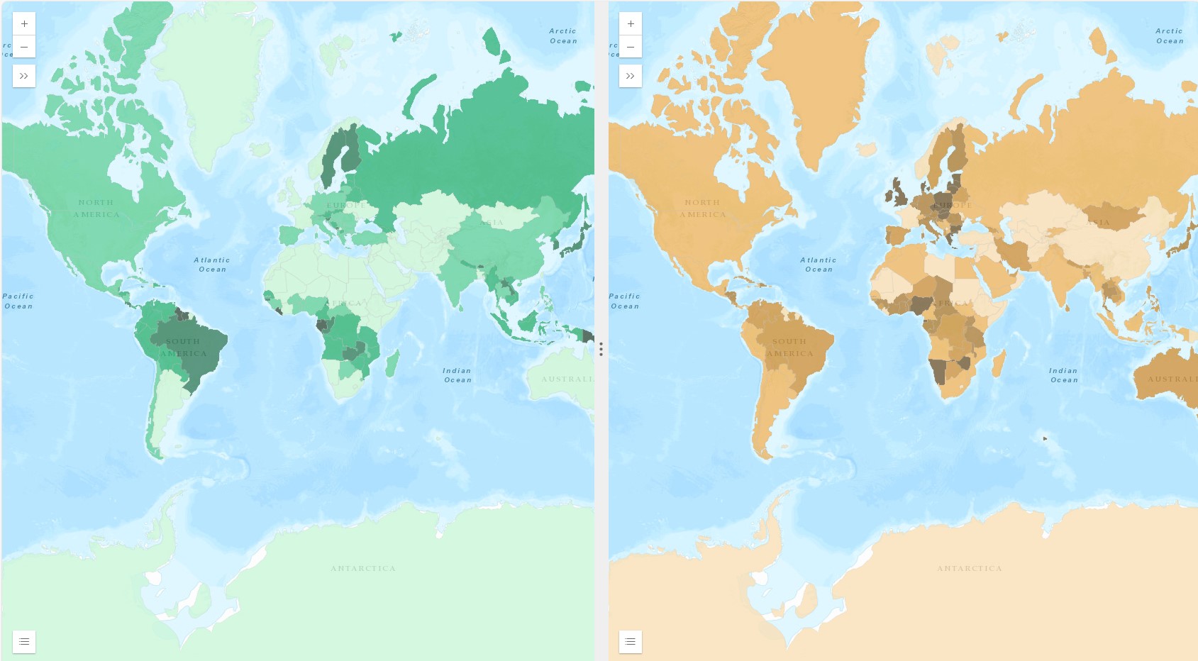
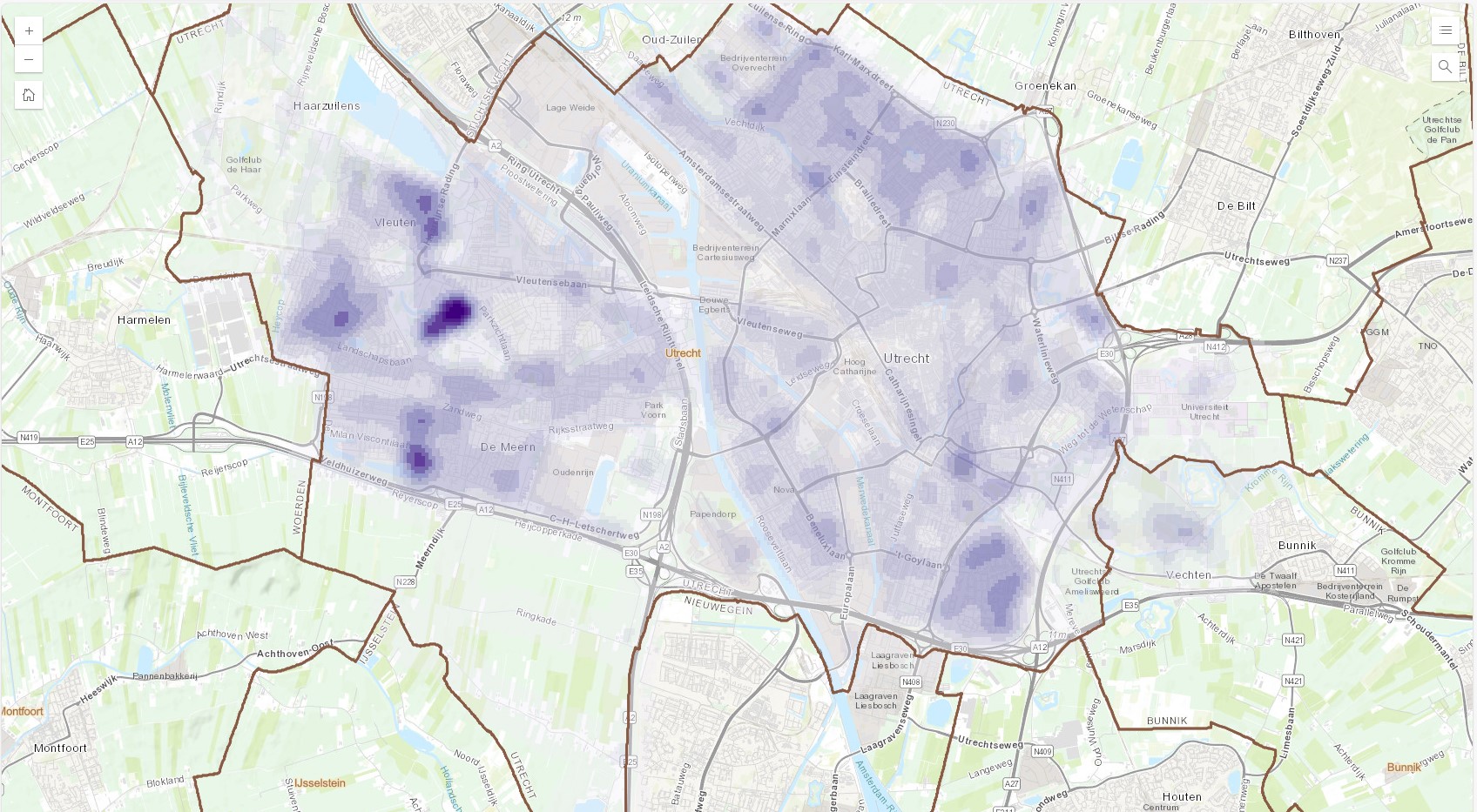
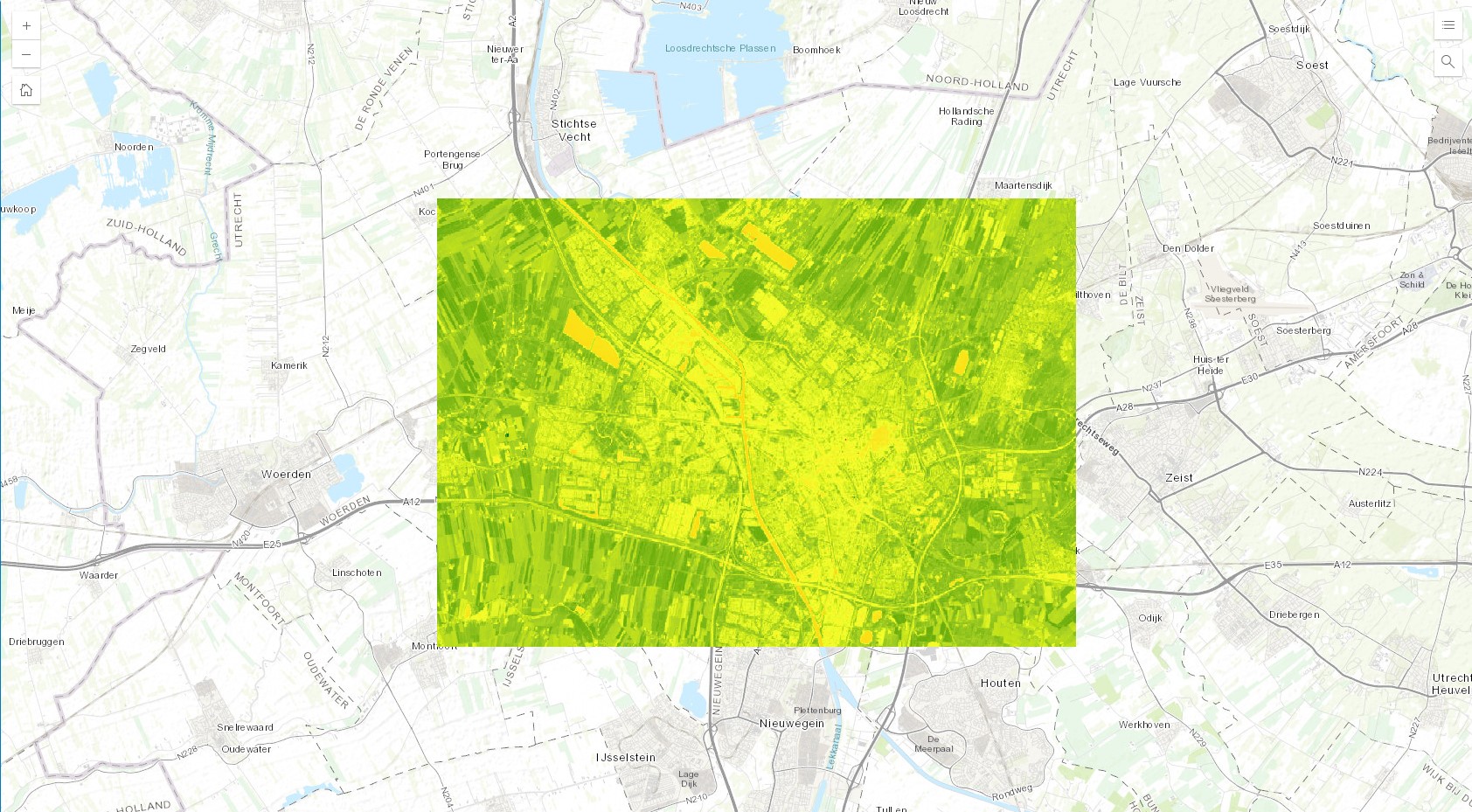
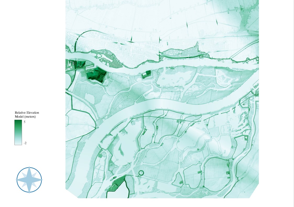
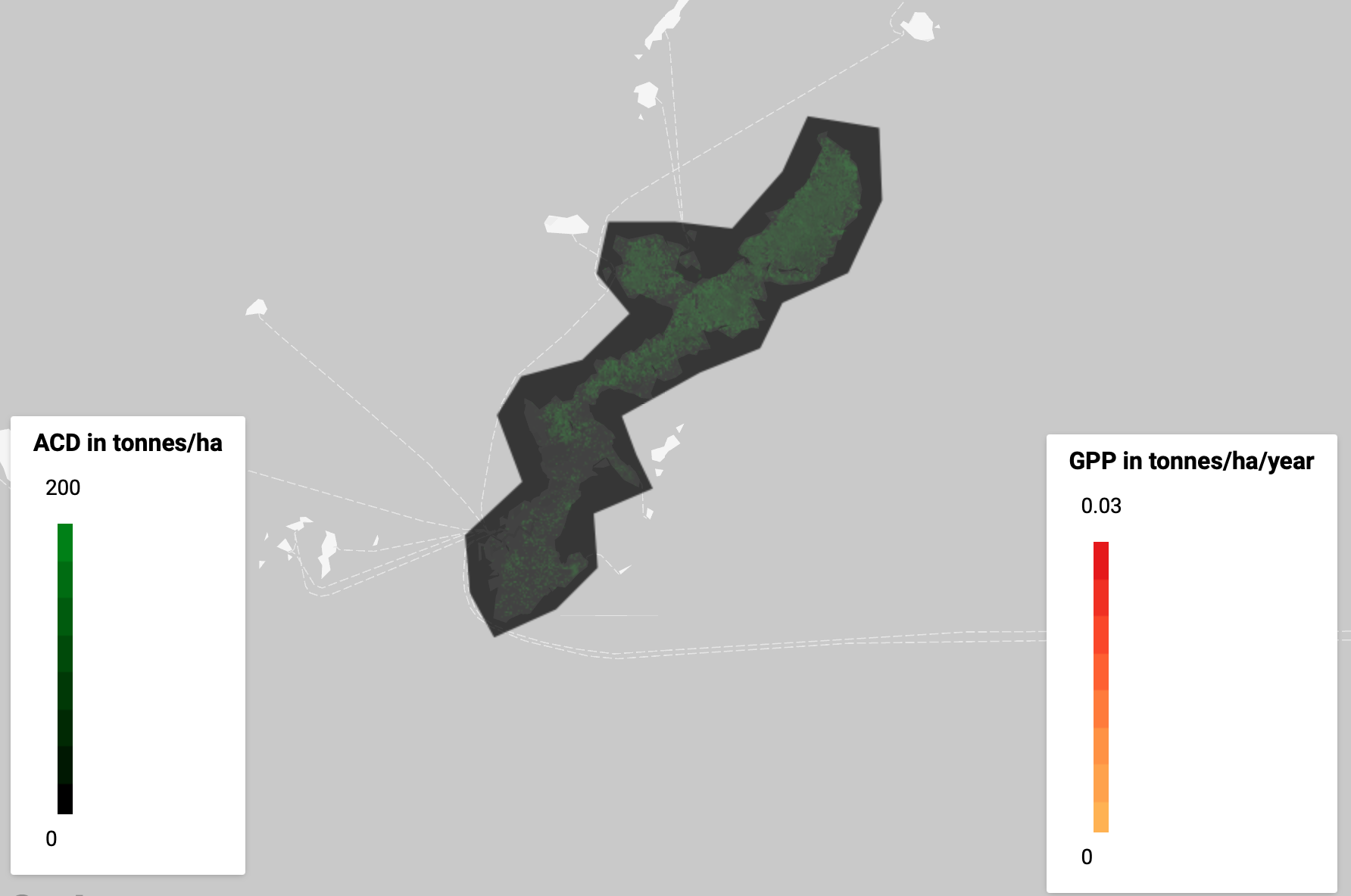
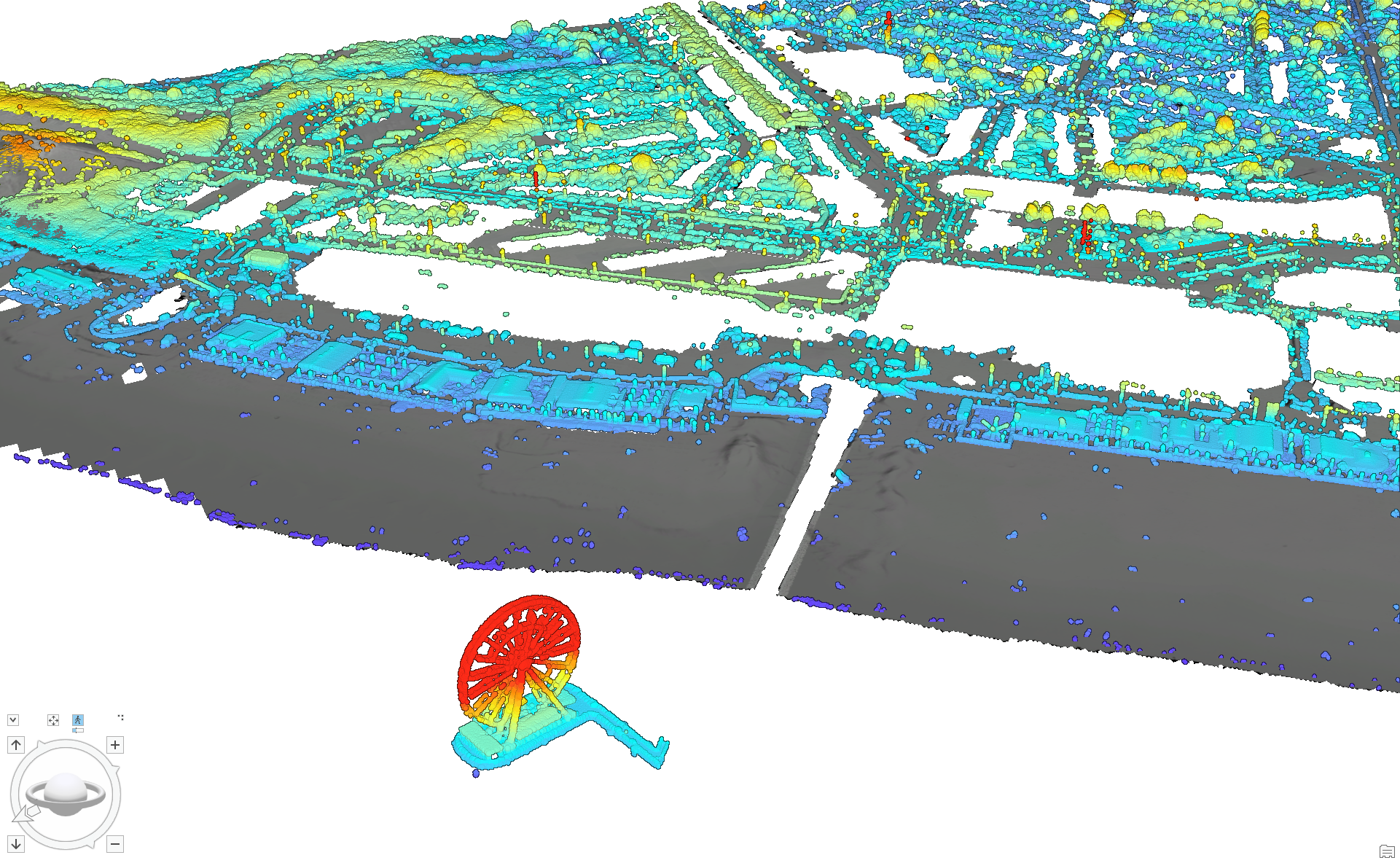
As part of my Geographical Information Systems (GIS) lab course, I have created a series of maps using various map-making software like QGIS, ArcGIS and Google Earth Search Engine. Geographic Information Science (GIScience) means to collect, analyse and visualise spatial data by integrating knowledge from various fields. Geographic Information Systems (GIS) are tools that manage, analyze, and present geographic data through software. These systems are incredibly valuable across many fields—like environmental management, urban planning, disaster response, public health and agriculture— providing crucial insights and solutions for complex spatial problems. By integrating spatial data with other types of information, GIS and GIScience allow for smarter, efficient and more informed decision-making. The maps on this website are centered around the theme of Sustainable Development Goal (SDG) 15: Life on Land. This goal emphasizes the importance of managing forests sustainably, combating desertification, halting and reversing land degredation and halting biodiversity loss.
I invite you to explore my work and gain insights into the critical issues related to Life on Land.